
Development Highlights
-
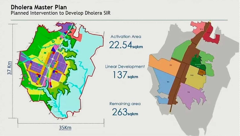
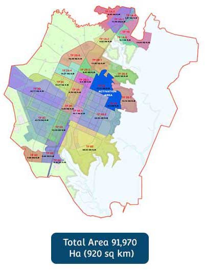
Dholera Special Investment Region (DSIR) spanning approximately 920sq km- encompasses 22 villages of Dholera Taluka.
-
DSIR, under Town Planning Schemes 1 to 6, covers an area of 422 sq km. Phase I covers 153 sq km of TP1 and TP2
-
Construction in an area of 2250 ha has been initiated for industrial and residential zones
-
DSIR is strategically located between industrial cities of Baroda, Ahmedabad, Rajkot and Bhavnagar.
-
DSIR is also connected to Delhi and Mumbai via NH8 & DMIC
-
DSIR provides access to both the domestic and international markets and land parcels can be combined to get a contiguous area
Development Plan
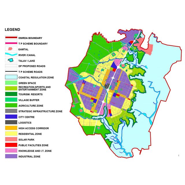
The Draft Development Plan aims at the creation of an economically and socially balanced, new age city with world-class infrastructure and a high quality of life. Adoption of a sustainable approach across key components such as transportation, waste recycling, overall urban form and resource efficiency form the cornerstones of this plan.
0
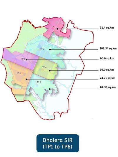
Total Town Planning in Dholera SIR
0
Total Sub TP in Dholera SIR
0
Total Area of Dholera SIR
TP 1
TP 1 Development Area - 51.4 Sq. Km. and Divide 6 Sub TP Planning.
TP 2
TP 2 Development Area - 102.34 Sq. Km. and Divide 8 Sub TP Planning.
TP 3
TP 3 Development Area - 66.6 Sq. Km. and Divide 4 Sub TP Planning.
TP 4
TP 4 Development Area - 60.0 Sq. Km. and Divide 3 Sub TP Planning.
TP 5
TP 5 Development Area - 74.75 Sq. Km. and Divide 4 Sub TP Planning.
TP 6
TP 6 Development Area - 67.33 Sq. Km. and Divide 2 Sub TP Planning.
The Land Use Allocation
Zone wise allocation in Dholera SIR.